Geography
The country of Aotearoa has an exceptional environment, hence why the population and government wants to preserve it. With a very rich diversity of animal and plant species, mountain ranges and rivers, it’s certainly worth taking a look.
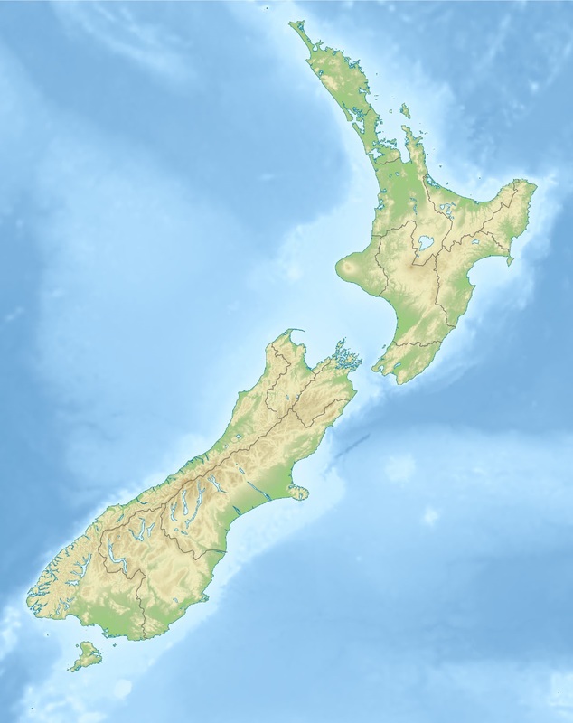
The geographic coordinates of Aotearoa are 40.9006° S, 174.8860° E. The Coordinates of its capital, Walderton, are 41.2865° S, 174.7762° E.
Before I get into the notable animals and plants, I think it’s necessary to do a general breakdown of the land itself.
The total area of Aotearoa is 268,838 kilometers squared. 264, 537 of the area is land, while the remaining 4, 301 km2 is water territory. The coastline of Aotearoa is 15, 134 km in length. The land is used primarily for agriculture, but there is also a large amount of forest land, roughly 31%.
90% of all the people live in the main cities of Aotearoa. There are 3 main cities in Aotearoa where people live. The first city, named Coast City, is located towards the north, but south of the town New Bristol. Coast city houses a larger portion of the population than the two other "main cities", even if it isn't the capital. The Capital, located right at the bottom of the North Island, is called Walderton. The largest city on the South Island was known as New Amsterdam during the 18th century. In the modern era, it is known as Greybrick, due to the style of buildings left over from the colonization by the Dutch.
The climate has very different standards depending on which region of the country you are in. Generally the South Island has lower temperatures, and the mountainous regions are colder. The country has the four seasons, as it is not located within the tropics. As it is in the southern hemisphere, the summer occurs at the end/beginning of the year, while the winter occurs during the middle months.
Both islands have their share of mountains. The average elevation of the country is 388 meters above sea level. There are multiple mountain ranges over the country, the most famous being the Southern Alps (Named after the European mountain range). The tallest mountain in The Southern Alps (And the country on a whole) is Aoraki. It is 3, 754 meters above sea level.
Aotearoa also has many volcanoes, some of which have been active in recent memory. On the North Island, the most significant volcanic activity happens at Ruapehu, which remains active. Another volcano, known as Taranaki, produces avalanches. Earthquakes are also fairly frequent in Aotearoa.
Notable native plant species to Aotearoa include:
-Pohutukawa, a pink flowered tree, known as Aotearoa's Christmas tree
-Pata trees, similarly to Pohutukawa have pink flowers
-Podocarp trees, native to hardwood forests.
-Various species of Mistletoe
-200 different species of fern, of which 40% don't occur anywhere else in the world.
Notable Animal species:
-Kiwi, a flightless bird and the national symbol of the country.
- Tui, a native bird that feeds on nectar from native plants
-Various species of Geckos and other lizard species
-The Weta, a native invertebrate
The country of Aotearoa has an exceptional environment, hence why the population and government wants to preserve it. With a very rich diversity of animal and plant species, mountain ranges and rivers, it’s certainly worth taking a look.
The geographic coordinates of Aotearoa are 40.9006° S, 174.8860° E. The Coordinates of its capital, Walderton, are 41.2865° S, 174.7762° E.
Before I get into the notable animals and plants, I think it’s necessary to do a general breakdown of the land itself.
The total area of Aotearoa is 268,838 kilometers squared. 264, 537 of the area is land, while the remaining 4, 301 km2 is water territory. The coastline of Aotearoa is 15, 134 km in length. The land is used primarily for agriculture, but there is also a large amount of forest land, roughly 31%.
90% of all the people live in the main cities of Aotearoa. There are 3 main cities in Aotearoa where people live. The first city, named Coast City, is located towards the north, but south of the town New Bristol. Coast city houses a larger portion of the population than the two other "main cities", even if it isn't the capital. The Capital, located right at the bottom of the North Island, is called Walderton. The largest city on the South Island was known as New Amsterdam during the 18th century. In the modern era, it is known as Greybrick, due to the style of buildings left over from the colonization by the Dutch.
The climate has very different standards depending on which region of the country you are in. Generally the South Island has lower temperatures, and the mountainous regions are colder. The country has the four seasons, as it is not located within the tropics. As it is in the southern hemisphere, the summer occurs at the end/beginning of the year, while the winter occurs during the middle months.
Both islands have their share of mountains. The average elevation of the country is 388 meters above sea level. There are multiple mountain ranges over the country, the most famous being the Southern Alps (Named after the European mountain range). The tallest mountain in The Southern Alps (And the country on a whole) is Aoraki. It is 3, 754 meters above sea level.
Aotearoa also has many volcanoes, some of which have been active in recent memory. On the North Island, the most significant volcanic activity happens at Ruapehu, which remains active. Another volcano, known as Taranaki, produces avalanches. Earthquakes are also fairly frequent in Aotearoa.
Notable native plant species to Aotearoa include:
-Pohutukawa, a pink flowered tree, known as Aotearoa's Christmas tree
-Pata trees, similarly to Pohutukawa have pink flowers
-Podocarp trees, native to hardwood forests.
-Various species of Mistletoe
-200 different species of fern, of which 40% don't occur anywhere else in the world.
Notable Animal species:
-Kiwi, a flightless bird and the national symbol of the country.
- Tui, a native bird that feeds on nectar from native plants
-Various species of Geckos and other lizard species
-The Weta, a native invertebrate